
Press release
Aerial Imaging Market Booming Global Growth & Trends - 3D Robotics, AeroVironment, DJI, EagleView, Fugro, Google, Nearmap, PrecisionHawk and senseFly

A slew of advancements in geospatial technology has been instrumental in adding impetus to aerial imaging market lately, to such as extent that government organizations to commercial businesses, have now found ways to utilize the technology to their own advantage. Hurricane Harvey is one of the most iconic examples that demonstrates the progress of aerial imaging industry. The prompt intervention of EagleView Technologies had then restored some relief to the hurricane affected victims, while simultaneously increasing the popularity of aerial imaging.
Get Sample Copy of This Report @ https://www.gminsights.com/request-sample/detail/105
The companies operating in the aerial imaging market are focusing on offering affordable imaging services to the customers as well as forging strategic partnerships with leading market players to extend their portfolio of aerial photography services and enhance their technological expertise. For instance, in October 2017, Agribotix, one of the leading providers of drone-data processing solutions extended its partnership with The Climate Corporation, a subsidiary of Monsanto Company, to offer aerial imagery technology to the farmers in Brazil through solutions such as the Climate FieldView and Agribotix’s FarmLens platform. In another instance, in May 2018, DJI, a leading global manufacturer of consumer and commercial drones, entered into a strategic partnership with Microsoft to bring advanced machine learning and AI capabilities to DJI drones. DJI also selected Microsoft’s Azure as a preferred cloud computing platform to leverage the platform’s machine learning and AI capabilities to process large volumes of aerial imagery into actionable insights for its customers.
Some of the key players operating in the aerial imaging market are 3D Robotics, AeroVironment, Airobotics, Cooper Aerial Surveys Co., Cyberhawk, DIGITAL AERIAL SOLUTIONS LLC, DJI, DroneDeploy, EagleView, Fugro, GeoVantage, Getmapping, Global UAV Technologies LTD, Google, Hoverfly Technologies, Kucera International Inc., Landiscor Aerial Information, Nearmap,NRC Group ASA, PrecisionHawk, senseFly and Yuneec USA Inc.
There has been a significant increase in the incidents of natural disasters over the past four decades. According to the Centre for Research on the Epidemiology of Disasters (CRED), the Emergency Events Database (EM-DAT) reports that the frequency of natural disasters has increased nearly three-fold from over 1,300 events in 1975–1984 to over 3,900 in 2005–2014. Aerial imaging largely facilitates the timely assessment of affected areas and assists in quickly expediting appropriate repair and relief operations.
Make an Inquiry for purchasing this Report @ https://www.gminsights.com/inquiry-before-buying/105
The UAV/drone platform held a major market share of around 71% in 2017 due to its rapidly growing adoption of the platform for aerial imaging in a diverse set of sectors including government, construction, oil & gas, military & defense, and agriculture. UAVs prove to be a cost-effective alternative to helicopters and fixed-wing aircraft for aerial imaging, which enables their adoption for small-scale and low-budget imaging applications. There has been a significant decline in the usage of traditional aerial photography platforms, such as parachutes, balloons, kites, and vehicle-mounted poles, due to the advent of drone technology that serves as a reliable alternative for capturing aerial images in varying climatic conditions.
The geospatial mapping segment dominated the aerial mapping market in 2017 due to the extensive applications of different aerial imaging modalities in geospatial mapping functions. Aerial images are utilized for photogrammetric mapping services that use remote sensing technologies and photogrammetry to produce geospatial mapping deliverables.
The urban planning segment is projected to register the fastest growth of over 17% between 2018 and 2024 due to the increasing adoption of aerial photography by government institutions for improving road planning, real estate management, and land use calculations. As aerial images provide city planners with regular up-to-date information on traffic patterns, buildings, railroads, bridges, water features, and other urban infrastructure components, their utility for urban planning is expected to grow significantly over the forecast period.
Browse Report Summery @ https://www.gminsights.com/industry-analysis/aerial-imaging-market
The military & defense market is expected to exhibit the fastest growth between 2018 and 2024 with a CAGR of over 15%. This high growth is attributed to the large-scale adoption of aerial imaging platforms in the defense sector for applications such as mission simulation, mission planning, and air defense planning. Aerial images are also used for mapping applications, wherein the maps are used for planning military operations and enabling ground-based combat troops to find their way.
North America is projected to account for the majority market share of around 42% by 2024 due to large-scale investments in aerial imaging technologies by major market players such as Google and government institutions such as the Federal Aviation Administration (FAA) in the U.S. Due to the rapid adoption of UAVs for imaging applications in the agriculture sector in the U.S., the region is expected to witness a steady growth between 2018 and 2024.
About Global Market Insights
Global Market Insights, Inc., headquartered in Delaware, U.S., is a global market research and consulting service provider; offering syndicated and custom research reports along with growth consulting services. Our business intelligence and industry research reports offer clients with penetrative insights and actionable market data specially designed and presented to aid strategic decision making. These exhaustive reports are designed via a proprietary research methodology and are available for key industries such as chemicals, advanced materials, technology, renewable energy and biotechnology.
Contact Us
Arun Hegde
Corporate Sales, USA
Global Market Insights, Inc.
Phone: 1-302-846-7766
Toll Free: 1-888-689-0688
Email: sales@gminsights.com
Web: www.gminsights.com
Permanent link to this press release:
Copy
Please set a link in the press area of your homepage
to this press release on woodPRI. woodPRI disclaims liability for any content contained in
this release.
Recommend

/newsMicroencapsulation Market Deep Analysis on Key Players - Dow Corning, Encapsys, Syngenta Crop Protection, Evonik Industries, 3M and Bayer
Market Study Report Adds Global Microencapsulation Market Size, Status and Forecast 2024 added to its database. The report provides key statistics on the current state of the industry and other analytical data to understand the market.
Extensive research is required for choosing the appropriate cor...

/newsGermany Airbag Market Size 2023: Global Share, Industry And Report Analysis By 2030 | Hyundai Mobis Co., Ltd. Key Safety Systems, Inc. Robert Bosch GmbH
Germany airbag market is expected to grow at a CAGR of around 6% during the forecast period. Germany Airbag Market research report refers to gathering and analyzing significant market data serve as best medium for various industry players to launch novel product or service. It is vital for key firms...
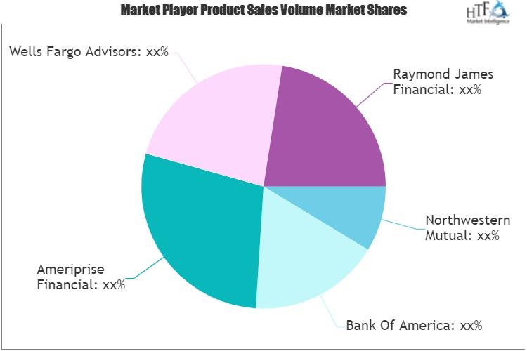
/newsSecurities Brokerages And Stock Exchanges Market Outlook 2021: Big Things are Happening
A new intelligence report released by HTF MI with title "Global Securities Brokerages And Stock Exchanges Market Survey & Outlook" is designed covering micro level of analysis by Insurers and key business segments, offerings and sales channels. The Global Securities Brokerages And Stock Exchange...

/newsRenewable Chemicals Market Emerging Trends and Competitive Landscape Forecast to 2028
The renewable chemicals market was valued at US$ 80,566.30 million in 2021 and is projected to reach US$ 1,76,750.76 million by 2028 it is expected to grow at a CAGR of 11.9% from 2021 to 2028. The research report focuses on the current market trends, opportunities, future potential of the market, a...
/newsHow Coronavirus is Impacting Cold Brew Coffee, Global Market Volume Analysis, Size, Share and Key Trends 2020-2026
"Market Latest Research Report 2020:
Los Angles United States, February 2020: The Cold Brew Coffee market has been garnering remarkable momentum in the recent years. The steadily escalating demand due to improving purchasing power is projected to bode well for the global market. QY Research's lates...
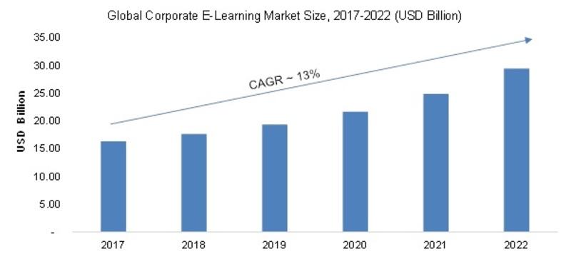
/newsCorporate E-Learning Market - Global Industry Size, Share, Key Players Analysis that are Infor, SkillSoft Corporation, Adrenna, CERTPOINT Systems and others with Regional Forecast to 2022
Overview:
E-Learning is used to enhance the learning procedures for newer job requirements and to make employees sound about the internal and external changes in the market and respective organizations. This method has created considerable differences in the ways of training and developing employee...